Sauerland
Travel Information
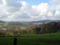
The Sauerland
is a rural, hilly area spreading across most of the south-eastern part
of North Rhine-Westphalia,
in parts heavily forested and, apart from the major valleys, sparsely inhabited.
 It
has been chosen as the first place in Germany where the Wisent or European
bison will be reintroduced mainly because of its large forests, and to
help boost the tourism industry by attracting visitors to the region. It
has been chosen as the first place in Germany where the Wisent or European
bison will be reintroduced mainly because of its large forests, and to
help boost the tourism industry by attracting visitors to the region.
To the west the hills continue
into the Bergisches Land, to the south into the Siegerland, and to the
north-east into the Teutoburg Forest. The major rivers of the Sauerland
are the Ruhr and the Lenne. Several artificial lakes were created on the
smaller rivers by building dams to store water for the nearby Ruhr area,
the biggest reservoirs being the Möhne and Bigge. Although the highest
elevation of the Sauerland is the Langenberg (843 m) near Olsberg, the
much more renowned summit, which is well-known for the nearby skiing facilities,
its weather station and observation tower, is the slightly lower Kahler
Asten (842 m) near Winterberg. Both Langenberg and Kahler Asten are parts
of the Rothaargebirge.
The largest town of the Sauerland
is Iserlohn followed by Lüdenscheid and Arnsberg. One of the biggest
prehistorical caves of Europe is situated in Balve; the largest accessible
limestone cave ouside the Alps is in Attendorn.
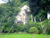
Meschede is the home of an
abbey.
read
more |